Troodos mountains · Troodos National Forest Park
Artemis trail
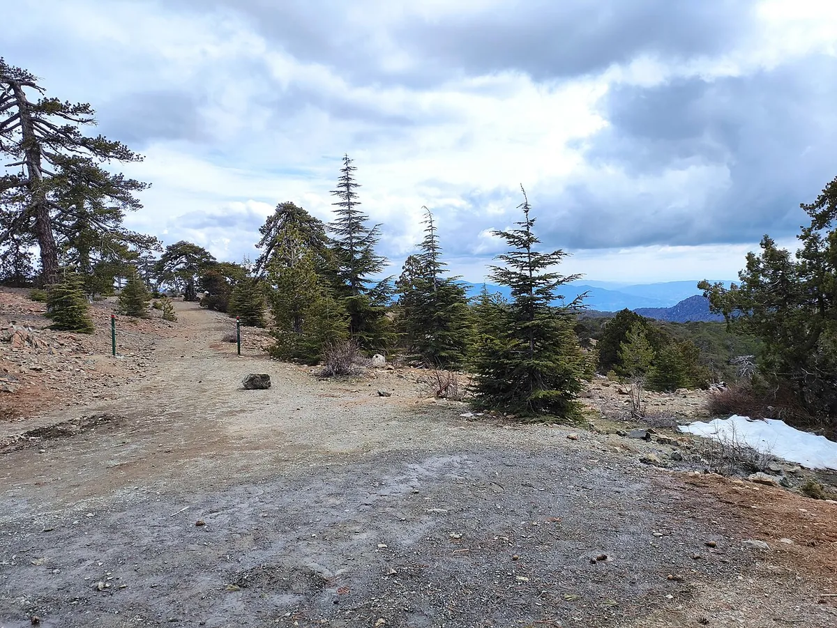
The highest marked trail in Cyprus: a gentle loop around the summit of Mount Olympos through black pine forest, with views in every direction.
7 km
2½–3 hours (official estimate)
Circular
Start 1,835 m · highest 1,850 m · end 1,835 m
On the Chionistra road, 300 m from where it meets the Troodos–Prodromos road.
Back at the start (circular).
No drinking water point is listed on the trail. Carry enough for the whole loop.
Troodos National Forest Park, Limassol district
About the trail
Artemis circles the top of Mount Olympos (Chionistra) at around 1,850 metres, making it the highest marked trail on the island. Because it follows the contour of the mountain, the climb is small for a walk of this length, which is why the official grade is the easiest of the three.
The path runs through black pine forest, past rock formations and rare mountain plants, with wide views across the island as you walk around the peak. It is a Troodos Geopark geotrail and runs parallel to the Atalanti trail about 100 metres below.
Note on the figures: Older Visit Cyprus brochures listed Artemis as grade 2; the current trail page and the 2026 map list grade 1.
What you’ll see
Highlights
- Two black pine trees around 500 years old
- Ruins of makeshift fortifications built in the last years of Venetian rule (1571 AD)
- Panoramic views from the highest trail in Cyprus
- Troodos National Forest Park Environmental Information Centre, about 2.2 km from the trail
Plants
- Black pine
- Cyprus skullcap
- Cyprus germander
- Troodos sage
Wildlife
- Fox, hare and hedgehog
- Bonelli’s eagle, Eurasian jay, wood pigeon and partridge
- Endemic Cyprus warbler and Cyprus wheatear
- Cyprus viper and the endemic Cyprus snake
Plan and pack
When to go
Summer at this altitude is far cooler than the coast, which makes the high Troodos trails popular from late spring to autumn. Official advice still asks for care on long walks in June–August heat. In winter, snow and ice can cover the path; only walk then with suitable equipment and after checking conditions.
Tips for this trail
- Easy grade, but you are at 1,850 m: bring a warm layer even in summer.
- Combine with the Atalanti trail if you want a longer day.
Pick the right grade
Grades come from the official trail map: 1 star is easy, 2 is moderate, 3 is difficult (steep, rocky or long). Choose a route that matches the least experienced person in your group.
Carry water and sun protection
Most fountains on the trails are not drinking water. Take plenty of water, a hat, sunglasses and sunscreen; summer temperatures can exceed 40°C on the coast.
Wear proper shoes
Trails are rocky, with steep slopes and stream crossings in places. Walking shoes or boots with good grip make a big difference.
Plan the return first
Rural buses can be infrequent and phone signal patchy. Know your last departure or fix a pickup time before you start, especially on linear trails.
Connects with
Getting to the trailhead
Bus
EMEL route 64 runs between Limassol and Troodos via Saittas. The trail starts on the Chionistra road, not at the Troodos Square stop area, so add the approach from wherever the bus sets you down. Check the current timetable for your travel date and plan around the return departure before you start walking.
Check a bus journeyChoose the matching place in the planner; no stop has been pre-selected.Taxi
Agree the fare, the drop-off point and a pickup at the same trailhead after the loop before leaving. Mobile coverage can be patchy in the forest, so fix a pickup time rather than relying on calling from the trail.
Rental car
Check mountain road and weather conditions before setting out. The directions link uses the official start coordinates where available; it is not a verified parking spot, so follow local signage.
More trails in Troodos mountains
Keep exploring
Questions about the Artemis trail
How long is the Artemis trail?
7 km, circular. The official walking estimate is 2½–3 hours. Add time for breaks, photos and getting to and from the trailhead.
How difficult is the Artemis trail?
It is graded 1 of 3 (easy) on the official Cyprus nature trails map. Altitude ranges from 1,835 m to 1,850 m.
Is the Artemis trail suitable for beginners?
Yes. It has the easiest official grade (1 of 3) and stays close to 1,835–1,850 m the whole way. The 7 km length still takes 2½–3 hours, so allow for breaks and mountain weather.
Sources and checked date
Trail facts checked 2026-10-09 against the sources below. Trails can close temporarily for maintenance or fire risk; check current notices and the weather for your date.
Visit Cyprus: Artemis trail ↗Visit Cyprus: 2026 nature trails map (PDF) ↗EMEL: route 64 Limassol – Saittas – Troodos ↗