Troodos mountains · Pano Platres (managed by the local authority)
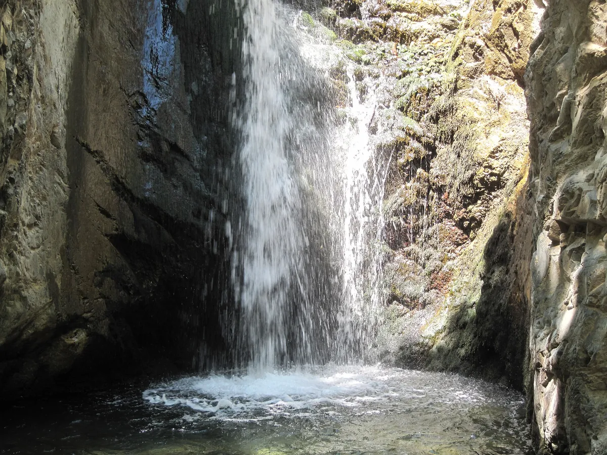
Millomeris waterfall trail
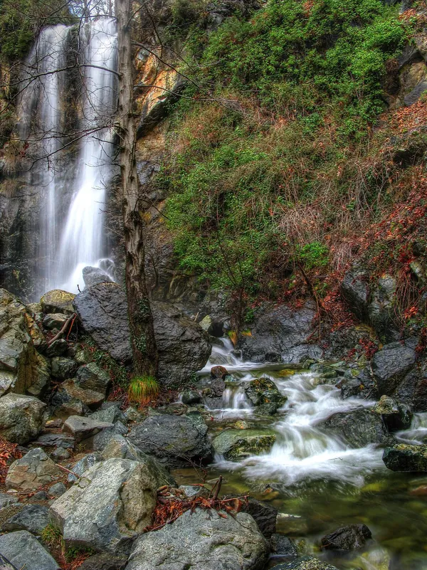
A short but steep walk down from Pano Platres along the Kryos Potamos to one of the tallest waterfalls in Cyprus.
1.2 km one way
30–45 minutes one way (official estimate)
Linear
Start 1,070 m · highest 1,070 m · end 980 m
Between Faneromeni church in Pano Platres and the village centre, closer to the church.
Millomeris waterfall; return the same way.
There is no drinking water on the route.
Pano Platres (managed by the local authority), Limassol district
About the trail
This short trail drops from Pano Platres beside the Kryos Potamos river to the Millomeris waterfall, hidden in the mountainside. The lower part is green and lush along the river; higher up the slope is open scrub with views to the south.
The trail is outside the national forests, so the Pano Platres local authority maintains it. The current trail map grades it 3 of 3 because of the descent, river crossings and slippery ground near the water. You walk back up the same way.
Note on the figures: An older official description graded this trail 1 with a 45-minute walk and a 20 m waterfall; the 2026 map lists grade 3 and 30 minutes. We show the current grade.
What you’ll see
Highlights
- Millomeris waterfall, one of the tallest in Cyprus
- Lush vegetation along the Kryos Potamos river
- Open mountainside with views to the south
- Easy to combine with lunch in Platres
Plants
- Lush vegetation along the Kryos Potamos river
- Scrub and maquis plants on the open slopes
Plan and pack
When to go
The older official description recommends March to November. The waterfall is fullest after the winter and spring rains.
Tips for this trail
- The way back is uphill: allow more time than for the descent.
- Expect slippery rocks and river crossings near the waterfall.
Pick the right grade
Grades come from the official trail map: 1 star is easy, 2 is moderate, 3 is difficult (steep, rocky or long). Choose a route that matches the least experienced person in your group.
Carry water and sun protection
Most fountains on the trails are not drinking water. Take plenty of water, a hat, sunglasses and sunscreen; summer temperatures can exceed 40°C on the coast.
Wear proper shoes
Trails are rocky, with steep slopes and stream crossings in places. Walking shoes or boots with good grip make a big difference.
Plan the return first
Rural buses can be infrequent and phone signal patchy. Know your last departure or fix a pickup time before you start, especially on linear trails.
Getting to the trailhead
Bus
No bus service to Platres was confirmed in the operator pages we checked. Check Cyprus Public Transport’s journey tools for your date, or use a taxi or car.
Check a bus journeyChoose the matching place in the planner; no stop has been pre-selected.Taxi
Agree the fare, the drop-off point and where the driver will meet you in Pano Platres before leaving. Mobile coverage can be patchy in the forest, so fix a pickup time rather than relying on calling from the trail.
Rental car
Park in Pano Platres and walk to the trailhead near Faneromeni church. Village streets are narrow; use signed parking.
More trails in Troodos mountains
Keep exploring
Questions about the Millomeris waterfall trail
How long is the Millomeris waterfall trail?
1.2 km one way, linear. The official walking estimate is 30–45 minutes one way. Add time for breaks, photos and getting to and from the trailhead.
How difficult is the Millomeris waterfall trail?
It is graded 3 of 3 (difficult) on the official Cyprus nature trails map. Altitude ranges from 980 m to 1,070 m.
How long is the walk to Millomeris waterfall?
About 1.2 km each way. The 2026 map estimates 30 minutes one way; allow 1½ hours for the round trip with time at the waterfall and the uphill return.
Sources and checked date
Trail facts checked 2026-10-09 against the sources below. Trails can close temporarily for maintenance or fire risk; check current notices and the weather for your date.
Visit Cyprus: 2026 nature trails map (PDF) ↗Visit Cyprus: Platres village ↗Cyprus Public Transport: maps and journey tools ↗